
by Nancy Christofferson
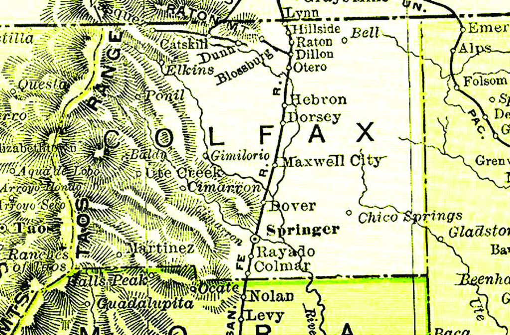
 COLFAX — Colfax County will celebrate its 147th anniversary Jan. 25. It was created in 1869 from the eastern portion of Taos County and named for the vice president of the United States of the time, Schuyler Colfax.
Schuyler Colfax as a vice president does not come readily to mind when one is asked to name his or her favorite veep, but perhaps he should. There are all kinds of geographical features named for him, from towns in five states to a mountain and from schools to streets, including the noted Colfax Avenue in Colorado’s state capital.
Colfax County is notable in many ways, but historically it may be unmatched. While 147 years seems relatively young, the area’s known history stretches into ancient times. For instance, the Folsom people were found by their remains to have wandered the eastern plains of the county as early as 9000 B.C., or 11,000 years ago. A Folsom site is but one of the 28 recognized properties or districts listed on the National Register of Historic Places in Colfax County.
Besides the ancient native presence in Colfax County, many early Spanish became familiar with it as they explored the plains, valleys and mountains of the far west. It is thought that Francisco Vasquez de Coronado was the first to transverse it as far back as 1541 while seeking the fabled golden city of Quivira on the Great Plains. This is a mere 50 years after the discovery voyage of Christopher Columbus.
More than 150 years passed before Don Diego de Vargas traveled with his troops through the area in 1696 in search of the Picuris Indians, who were believed to have been kidnapped by Apaches. Just 10 years later, in 1706, Juan de Ulibarri did the same, still looking for those same missing Picuris. Ulibarri’s route carried him north through Las Animas and Huerfano counties as well. Both the Valverde and Villasur expeditions followed in the early 1700s. Valverde made it all the way into Kansas. Villasur did not fare so well – he was killed by Indians, most likely Pawnees, near the North Platte River. These men could be considered the true fathers of the Santa Fe Trail.
The Spanish began colonizing in northeastern New Mexico in the 1600s. In the late 1700s and early 1800s, French Canadian trappers began settling down here after their lives of adventure in the mountains led them south to more pastoral leanings.
Merchants and speculators began crossing the prairies from the United States in the early 1800s, only to be imprisoned by Spanish authorities who had banned foreigners. After Mexico won its independence in 1821, the borders were opened to trade and immigration. Many of the traders made their homes in the area.
The War with Mexico brought the armies of the United States into Colfax County. Following the treaty in 1848, settlers came from the east and joined the former trappers and traders living there. Villages sprang up all along the water courses where agriculture was possible through the use of acequias, or irrigation ditches, and herds of cattle and sheep vied with the resident buffalo and antelope. Stagecoaches across the plains and Raton Pass, opened as a toll road in 1865, brought more newcomers.
In 1866 copper was discovered in the mountains and the following year, gold. The most famous of the gold camps was Elizabethtown, called E-town, which became Colfax County’s first seat of government. The camp boasted more than 100 buildings, an irrigation system, and a peak population of 7,000. By 1871 it was rapidly becoming a ghost town with a population of 100. Other mining camps included Hematite, Baldy, Twining and Virginia City.
While the gold rush in the western end of the county was waning, coal mining in the northeast was gaining. The largest of these mines was Dawson which grew to house nearly 10,000 residents before the company closed the mines, but the first to boom was Blossberg near Raton. The first telephone in Colfax County was located in a doctor’s office in Blossberg, and the town had all the amenities from saloons, a camp band and a newspaper before it was flooded in 1886. Its end came about 1895 after a miners’ strike led many to abandon the camp for others being opened in the same vicinity.
The agricultural centers greatly outnumbered the mining camps. Cimarron would be considered one of these, with its flour mill and many businesses (and saloons). Settled in 1841 because of its location on the vast Beaubien- Miranda Land Grant, it was a principal stop on the Santa Fe Trail in the 1860s when Lucien Maxwell became the first postmaster. Later it served gold miners, the Ute Reservation, and tourists. It was the second county seat. It is said Buffalo Bill created his first Wild West show in Cimarron, which truly was a wild town in early days.
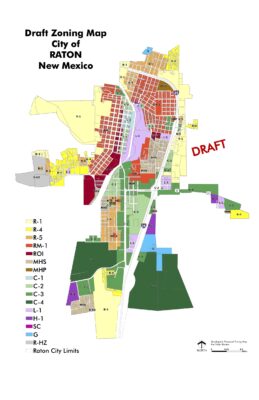
Springer, too, was an important mercantile center for local ranchers. After its settlement in 1879, it became Colfax County’s third county seat before it was overshadowed by Raton, which was basically founded by the Atchison, Topeka and Santa Fe Railroad in 1880. Raton encompassed the old watering spot and government forage station on the Santa Fe Trail called Willow Springs for decades but the Santa Fe Railroad’s arrival began the city’s growth and future.
While Lucien Maxwell might well be Colfax county’s richest resident of yore, his friend Kit Carson could well be the most famous in terms of recognition of the name. Carson settled at Rayado in 1841, thinking himself retired from government service, but it was not to be. Carson is intrinsically bound into the histories of northern New Mexico and southeastern Colorado.
Then there is the geography of Colfax County. The foothills lead into the Sangre de Cristos on the west. It was here the gold was found. New Mexico’s highest point, Wheeler Peak, 13,161 feet in altitude, is here (though just west of the county line) along with many other behemoths that defied early explorers.
Its eastern plains are just like those of Las Animas and Huerfano counties. Here lived the cattle barons on their huge ranches, and the homesteaders on their modest claims.
Colfax has a half dozen mountain passes linking it to Las Animas County to the north, used through the centuries by Native Americans, Spanish troops, mountain men and settlers. Indeed, many of the earliest colonists of Las Animas and Huerfano counties used these byways.
Colfax contains the upper reaches of the Canadian, Vermejo and Canadian rivers. Its 3,768 square miles also include the historic Philmont Boy Scout Ranch, the National Rifle Association’s Whittington Center, the vast privately-owned Vermejo Park, Santa Fe Trail ruts, Vietnam Veterans Chapel, Sugarite Canyon Park, Folsom Man and Dorsey Mansion State Parks, recreation areas such as Eagle Nest Lake, Cimarron Canyon State Park, Carson National Forest, Kiowa National Grasslands and Maxwell National Wildlife Refuge, museums and historic sites (such as one called Black Jack’s Hideout and the spot where Huerfano County Sheriff Ed Farr was killed in 1899 by train robbers).
All in all, it features some of the same scenery admired by Spanish explorers and other travelers for more than 450 years.